Difference between revisions of "Nebraska Historical Marker: Webster County, 1871-1971"
(Created page with "[[Image:________ |thumb|center|upright=3.0|alt=________]] ==Location== 600-698 N Seward St, Red Cloud, Webster County, Nebraska View this marker's location '''[https://maps....") |
|||
| (4 intermediate revisions by 3 users not shown) | |||
| Line 1: | Line 1: | ||
| − | [[Image: | + | [[Image:NHM_123_1_1.jpg|thumb|center|upright=3.0|alt=NHM_123_1_1.jpg]] |
==Location== | ==Location== | ||
| − | 600-698 N Seward St, Red Cloud, Webster County, Nebraska | + | 600-698 N Seward St, County Courthouse, Red Cloud, Webster County, Nebraska |
| − | View this marker's location '''[https:// | + | View this marker's location '''[https://www.google.com/maps/place/40%C2%B005'27.9%22N+98%C2%B031'16.7%22W/@40.091075,-98.5218462,206m/data=!3m2!1e3!4b1!4m5!3m4!1s0x0:0x0!8m2!3d40.091074!4d-98.521299?hl=en 40.091074, -98.521299]''' |
| − | + | {{Marker:Map}} | |
==Marker Text== | ==Marker Text== | ||
| Line 14: | Line 14: | ||
==Further Information== | ==Further Information== | ||
| − | + | [[Image:Webster_County_Jail_Postcard.jpg|thumb|center|upright=3.0|alt=Webster_County_Jail_Postcard.jpg]] | |
==Bibliography== | ==Bibliography== | ||
| − | + | Elton A. Perkey, “Perkey’s Nebraska Place Names” (1995), Nebraska State Historical Society | |
| − | + | {{Marker:Program}} | |
| − | + | ||
Latest revision as of 14:49, 22 January 2018
Location
600-698 N Seward St, County Courthouse, Red Cloud, Webster County, Nebraska
View this marker's location 40.091074, -98.521299
View a map of all Nebraska historical markers, Browse Historical Marker Map
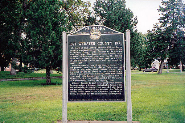
Marker Text
On April 10, 1871, Acting Governor William James issued a proclamation calling for the organization of Webster County, with officials to be elected nine days later. The dugout of Silas Garber, later to serve as Nebraska's governor, was the polling place and forty-five votes were cast. A portion of Garber's claim, future Red Cloud, was voted the county seat. When the first settlers of the county had arrived the previous year, the Republican Valley was the center of the West's great buffalo ranges, still traversed by Indians while on their tribal hunts. Within a very few years, however, those times were gone, and, with the arrival of the railroad in 1879, Webster County was rapidly settled by thousands of homesteaders, ending the frontier era. Webster County is part of a prosperous mixed-farming region, with numerous irrigated farms, while the rolling divide country has provided rich lands for grazing. The faith of the pioneers, that Webster County would prove to be a wealthy, agricultural home, is proven by the surrounding countryside.
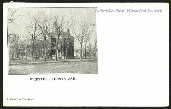
Further Information
Bibliography
Elton A. Perkey, “Perkey’s Nebraska Place Names” (1995), Nebraska State Historical Society
Marker program
See Nebraska Historical Marker Program for more information.

