Difference between revisions of "Nebraska Historical Marker: The Horse Creek Treaty - Map"
From E Nebraska History
| Line 16: | Line 16: | ||
==Bibliography== | ==Bibliography== | ||
| − | + | Burton S Hill, “The Great Indian Treaty Council of 1851,” Nebraska History 47 (1966): 85 -110 | |
{{Marker:Program}} | {{Marker:Program}} | ||
Revision as of 14:56, 21 September 2017
Location
30624 U.S. 26, Morrill, Scottsbluff County, Nebraska View this marker's location 41.972523, -104.0095
View a map of all Nebraska historical markers, Browse Historical Marker Map
Marker Text
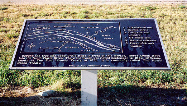
(Legend under map) Beyond the tree line about 2 3/4 miles in front of this marker, Horse Creek flows into the North Platte River. There the treaty was signed September 17, 1851. Officially known as The Fort Laramie Treaty of 1851, it is commonly called The Horse Creek Treaty.
Further Information
Bibliography
Burton S Hill, “The Great Indian Treaty Council of 1851,” Nebraska History 47 (1966): 85 -110
Marker program
See Nebraska Historical Marker Program for more information.
