Difference between revisions of "Nebraska Historical Marker: Original Union Pacific Main Line through Papillion"
(Created page with "Nebraska Historical Marker: Original Union Pacific Main Line through Papillion ==Location== Sump Library, 222 N Jefferson, Papillion, Sarpy County, Nebraska View this marker...") |
|||
| (One intermediate revision by the same user not shown) | |||
| Line 1: | Line 1: | ||
Nebraska Historical Marker: Original Union Pacific Main Line through Papillion | Nebraska Historical Marker: Original Union Pacific Main Line through Papillion | ||
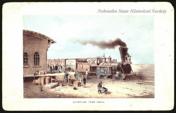
| + | [[Image:Departure_from_Omaha_lithograph.jpg|thumb|center|upright=3.0|alt=Departure_from_Omaha_lithograph.jpg]] | ||
==Location== | ==Location== | ||
Sump Library, 222 N Jefferson, Papillion, Sarpy County, Nebraska | Sump Library, 222 N Jefferson, Papillion, Sarpy County, Nebraska | ||
| Line 6: | Line 7: | ||
View this marker's location '''[https://www.google.com/maps/place/41%C2%B009'28.6%22N+96%C2%B002'33.9%22W/@41.157942,-96.0433092,238m/data=!3m2!1e3!4b1!4m5!3m4!1s0x0:0x0!8m2!3d41.157941!4d-96.042762?hl=en 41.157941, -96.042762]''' | View this marker's location '''[https://www.google.com/maps/place/41%C2%B009'28.6%22N+96%C2%B002'33.9%22W/@41.157942,-96.0433092,238m/data=!3m2!1e3!4b1!4m5!3m4!1s0x0:0x0!8m2!3d41.157941!4d-96.042762?hl=en 41.157941, -96.042762]''' | ||
| − | + | {{Marker:Map}} | |
==Marker Text== | ==Marker Text== | ||
| Line 17: | Line 18: | ||
==Bibliography== | ==Bibliography== | ||
| − | + | {{Marker:Program}} | |
| − | + | ||
Latest revision as of 13:05, 19 January 2018
Nebraska Historical Marker: Original Union Pacific Main Line through Papillion
Location
Sump Library, 222 N Jefferson, Papillion, Sarpy County, Nebraska
View this marker's location 41.157941, -96.042762
View a map of all Nebraska historical markers, Browse Historical Marker Map
Marker Text
Approximately thirty feet south of here in 1865 the Union Pacific Railroad laid its original track extending from the Missouri River in Omaha, south up Mud Creek to Papillion Creek, and northwesterly along West Papillion Creek. Although Chief Engineer Peter A. Dey had proposed a more direct route to reach the Elkhorn Valley, Union Pacific Vice President Dr. Thomas Durant and consulting engineer Silas Seymour instead selected the Papillion Creek alternative, adding nine miles to the line. Durant was accused of making the change to obtain additional government subsidies, but he defended the Papillion route as having gentler grades than the Dey route.
When E. H. Harriman gained control of the Union Pacific in 1897 he began modernization, including construction of the Lane Cut-off following Dey's original route. The cut-off opened in 1908, relegating the Durant line to a secondary role. Between 1988 and 1994, 7.3 miles of track on the original Durant line between Gilmore and Millard were removed. Rail customers in Millard are served from the west end of the original main line at Lane Junction in west Omaha.
Further Information
Bibliography
Marker program
See Nebraska Historical Marker Program for more information.
