Nebraska Historical Marker: Grand Island
Location
Historical Marker 171 near mile marker 314 rest area on I-80 eastbound, Grand Island, Hall County, Nebraska View this marker's location 40.82274, -98.32585
Historical Marker 172 near mile marker 317 rest area on I-80 westbound, Grand Island, Hall County, Nebraska View this marker's location 40.82194, -98.29513
View a map of all Nebraska historical markers, Browse Historical Marker Map
Marker Text
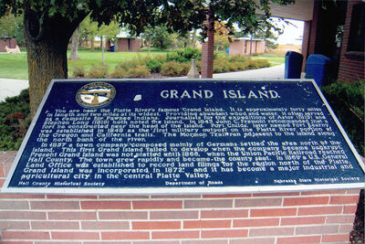
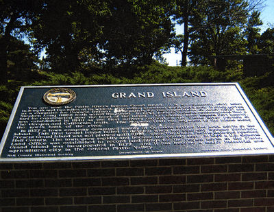
You are near the Platte River's famous Grand Island. It is approximately forty miles in length and two miles at its widest. Providing abundant wood and water, it often served as a campsite for Pawnee Indians. Journalists for the expeditions of Astor (1813) and Stephen Long (1819) both noted the island. In 1843 John C. Fremont recommended that a fort be constructed near the head of the island. Fort Childs, later named Fort Kearny, was established in 1848 as the first military outpost on the Platte River portion of the Oregon and California trails. The Mormon Trail ran adjacent to the island along the north bank of the river. In 1857 a town company composed mainly of Germans settled the area north of the island. This first Grand Island failed to develop when the company became bankrupt. Present Grand Island was not platted until 1866, when the Union Pacific Railroad reached Hall County. The town grew rapidly and became the county seat. In 1869 a U.S. General Land Office was established to record land filings for the region north of the Platte. Grand Island was incorporated in 1872, and it has become a major industrial and agricultural city in the central Platte Valley.
Further Information
Bibliography
Elton A. Perkey, “Perkey’s Nebraska Place Names” (1995), Nebraska State Historical Society
Marker program
See Nebraska Historical Marker Program for more information.

