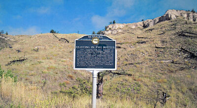
Difference between revisions of "Nebraska Historical Marker: Fighting in the Buttes"
(→Location) |
|||
| Line 4: | Line 4: | ||
==Location== | ==Location== | ||
| − | Fort Robinson State Park, | + | Old Smiley Scenic Drive, near Fort Robinson State Park, Sioux County, Nebraska |
View this marker's location '''[https://www.google.com/maps/place/42%C2%B039'54.8%22N+103%C2%B031'30.4%22W/@42.665209,-103.5256582,208m/data=!3m2!1e3!4b1!4m5!3m4!1s0x0:0x0!8m2!3d42.665209!4d-103.525111?hl=en 42.665209, -103.525111]''' | View this marker's location '''[https://www.google.com/maps/place/42%C2%B039'54.8%22N+103%C2%B031'30.4%22W/@42.665209,-103.5256582,208m/data=!3m2!1e3!4b1!4m5!3m4!1s0x0:0x0!8m2!3d42.665209!4d-103.525111?hl=en 42.665209, -103.525111]''' | ||
Revision as of 07:24, 25 September 2017
Nebraska Historical Marker: Fighting in the Buttes
Location
Old Smiley Scenic Drive, near Fort Robinson State Park, Sioux County, Nebraska
View this marker's location 42.665209, -103.525111
View a map of all Nebraska historical markers, Browse Historical Marker Map
Marker Text
After escaping from Fort Robinson on January 9, 1879, the Cheyennes climbed the buttes to the south and fled through this area, pursued by Third Cavalrymen. Soldiers and Cheyennes fought sharp engagements west of here on January 11 and 13. The pursuit continued to near the Wyoming border before the Cheyennes turned northeast. On January 22 the survivors reached Antelope Creek, north of present day Harrison. In a final charge by the soldiers, the last thirty-two Cheyennes were killed or captured.
Further Information
Bibliography
Marker program
See Nebraska Historical Marker Program for more information.
