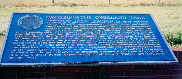
Nebraska Historical Marker: Crossing the Overland Trail
Location
Rural Interstate 80, Sutherland, Lincoln County, Nebraska
View this marker's location 41.138085, -101.095611
View a map of all Nebraska historical markers, Browse Historical Marker Map
Marker Text
Beneath this platform, evidence of the great westward migration still remains. These shallow depressions were once deep ruts created by thousands of hooves, shoes and wheels. The Overland Trail is often visualized as a single, well-defined roadway. However, except in narrow spots such as this, the actual route through the Platte Valley during any given year varied considerably, depending upon such factors as soil conditions and the availability of grass for the animals. Traveling an average of fifteen to twenty miles a day in various conveyances, the emigrants spent from four to six months on the trail during the long trek from the Missouri River to Oregon or California. At best, the journey was arduous, often marked only by the dusty monotony of daily routine. At other times, disease and Indian attacks were very real dangers, and the number of fresh graves along the road bore testimony to the sacrifices made by many pioneers. Some emigrants were better equipped than others, some were wiser, some were simply luckier; but all suffered weariness, hardship and danger. However, as the many overland diaries and letters testify, this was a great human experience, one which was vital to the settlement of the West.
Further Information
Bibliography
Donald F Danker, “The Influence of Transportation upon Nebraska Territory,” Nebraska History 47 (1966): 187-208
Marker program
See Nebraska Historical Marker Program for more information.
