File:Oregon Trail Map.jpg
From E Nebraska History
No higher resolution available.
Oregon_Trail_Map.jpg (640 × 460 pixels, file size: 89 KB, MIME type: image/jpeg)
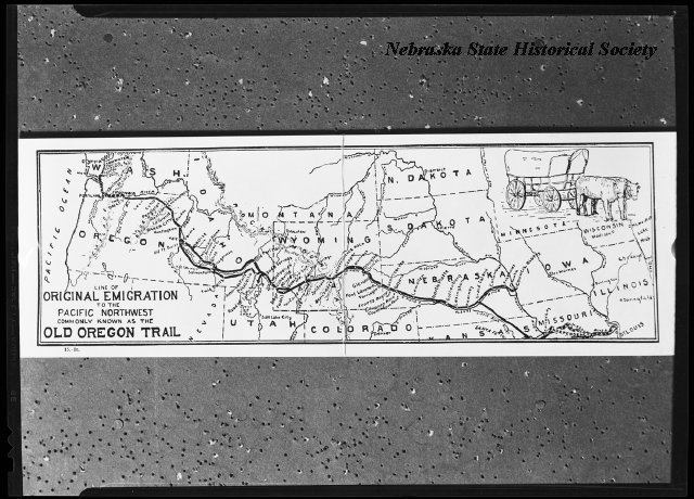
Information = Oregon Trail Map
Description = A map of the Old Oregon Trail from St. Louis to the west coast.
Source = RG3882 Dewell, Nathaniel L. 188?-1954
Date = Unknown
Author = Unknown
Permission = Content is available under Attribution-NonCommercial-NoDerivs 3.0 Unported. See http://creativecommons.org/licenses/by-nc-nd/3.0/
File history
Click on a date/time to view the file as it appeared at that time.
| Date/Time | Thumbnail | Dimensions | User | Comment | |
|---|---|---|---|---|---|
| current | 09:18, 9 January 2018 | | 640 × 460 (89 KB) | Joelle (Talk | contribs) | Information = Oregon Trail Map Description = A map of the Old Oregon Trail from St. Louis to the west coast. Source = RG3882 Dewell, Nathaniel L. 188?-1954 Date = Unknown Author = Unknown Permission = Content is available under Attribution-NonCom... |
- You cannot overwrite this file.
File usage
There are no pages that link to this file.