File:Map of Mud Springs.jpg
From E Nebraska History
Size of this preview: 505 × 599 pixels.
Original file (843 × 1,000 pixels, file size: 193 KB, MIME type: image/jpeg)
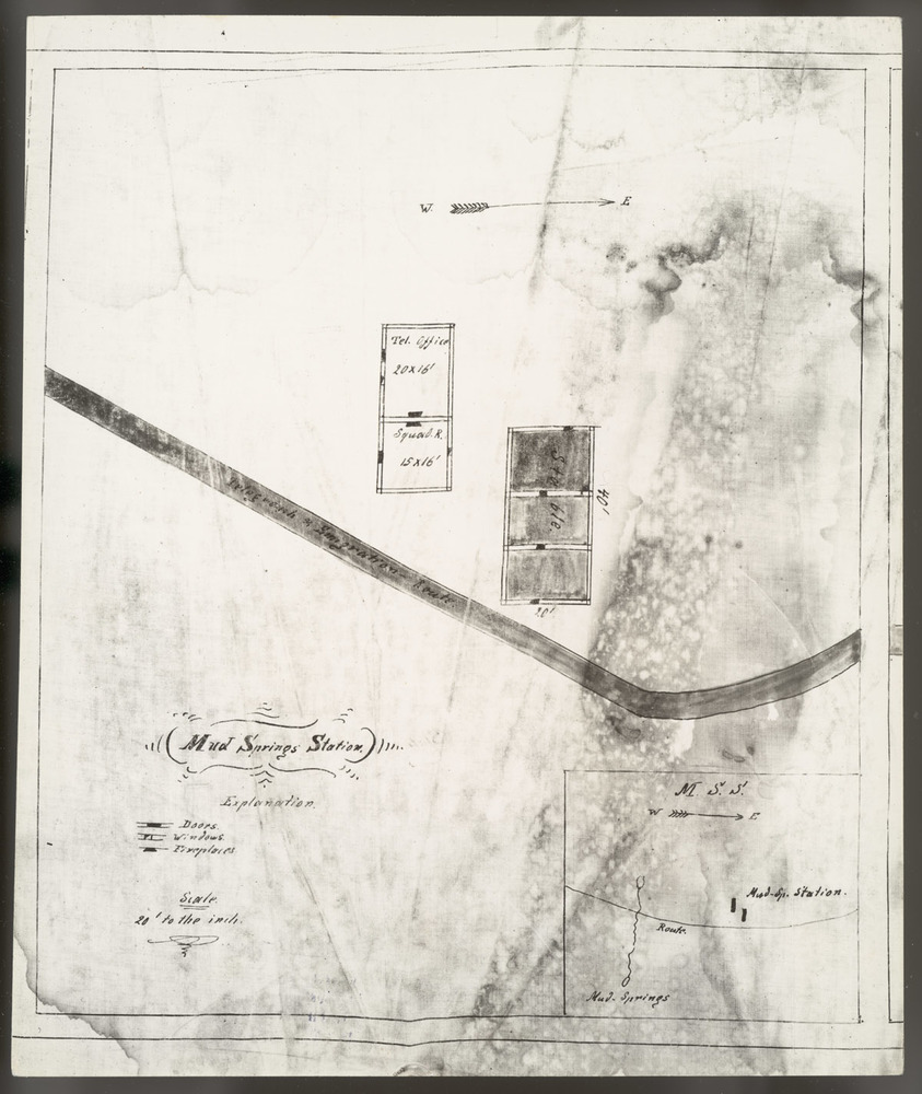
Information = Map of Mud Springs
Description = Map drawing of Mud Springs Station
Source = rg2409.ph0-000149, Nebraska State Historical Society
Date = Unknown
Author = Unknown
Permission = Content is available under Attribution-NonCommercial-NoDerivs 3.0 Unported. See http://creativecommons.org/licenses/by-nc-nd/3.0/
File history
Click on a date/time to view the file as it appeared at that time.
| Date/Time | Thumbnail | Dimensions | User | Comment | |
|---|---|---|---|---|---|
| current | 10:06, 18 January 2018 | | 843 × 1,000 (193 KB) | Joelle (Talk | contribs) | Information = Map of Mud Springs Description = Map drawing of Mud Springs Station Source = rg2409.ph0-000149, Nebraska State Historical Society Date = Unknown Author = Unknown Permission = Content is available under Attribution-NonCommercial-NoDe... |
- You cannot overwrite this file.
File usage
The following page links to this file: