File:Lincoln Highway Marker.jpg
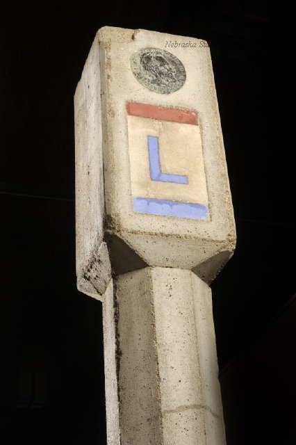
Information = Lincoln Highway Marker
Description = Lincoln Highway concrete marker with octagonal post. The post is topped with a vertical rectangle. The frontside of the post has a "L" in blue inside a white vertical rectangle with a red stripe on top and a blue stripe on the bottom. Above the "L" is a commemorative medal, with a profile of Abaraham Lincoln in the center, imbedded in the concrete. On the proper left side of the top rectangular piece is a blue curved arrow.
This concrete marker was used along the Lincoln Highway.
The Lincoln Highway Association formed in 1912 to establish the nation's first transcontinental highway, running from New York to San Francisco. Their goal was to develop a paved, marked, toll-free route, promoted by state and local boosters. Little more than a chain of existing roads when dedicated in 1913, the Lincoln Highway became U.S. Route 30, still driven today.
Source = Linch, Lee Collection, Nebraska State Historical Society
Date = Unknown
Author = Unknown
Permission = Content is available under Attribution-NonCommercial-NoDerivs 3.0 Unported. See http://creativecommons.org/licenses/by-nc-nd/3.0/
File history
Click on a date/time to view the file as it appeared at that time.
| Date/Time | Thumbnail | Dimensions | User | Comment | |
|---|---|---|---|---|---|
| current | 09:45, 9 January 2018 | | 426 × 640 (39 KB) | Joelle (Talk | contribs) | Information = Lincoln Highway Marker Description = Lincoln Highway concrete marker with octagonal post. The post is topped with a vertical rectangle. The frontside of the post has a "L" in blue inside a white vertical rectangle with a red stripe on to... |
- You cannot overwrite this file.
File usage
There are no pages that link to this file.