Nebraska Historical Marker: Ash Hollow (Keith)
Location
Rest Area I-80W milemarker 132, Ogallala, Keith County, Nebraska
View this marker's location 41.120174, -101.6037
View a map of all Nebraska historical markers, Browse Historical Marker Map
Marker Text
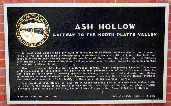
Ash Hollow was famous on the Oregon Trail. A branch of the trail ran northwestward from the Lower California Crossing of the South Platte River a few miles west of Brule, and descended here into the North Platte Valley. The hollow, named for a growth of ash trees, was entered by Windlass Hill to the south. Wagons had to be eased down its steep slope by ropes. Ash Hollow with its water, wood and grass was a welcome relief after the arduous trip from the South Platte and the travelers usually stopped for a period of rest and refitting. An abandoned trappers cabin served as an unofficial postoffice where letters were deposited to be carried to the "States" by Eastbound travelers. The graves of Rachel Pattison and other emigrants are in the nearby cemetery.
In 1855 a significant fight, commonly called the Battle of Ash Hollow, occurred at Blue Water Creek northwest of here. General Harney's forces sent out to chastise the Indians after the Grattan Massacre of 1854 here attacked Little Thunder's band of Brule Sioux while the Indians were attempting to parley, killed a large number and captured the rest of the band.
Further Information
Ash Hollow is a wooded canyon near the Platte River and was a major landmark along the Platte River Road. Four miles wide, 250 feet deep and ranging from 1,000 to 2,000 feet wide, it is a relatively small canyon but the largest canyon anywhere along the Platte.
Geography The most famous natural feature in Ash Hollow is Windlass Hill, a very steep incline that was the primary route into the canyon. Travelers did not call the hill “Windlass Hill” in those days; rather, it was called “the steep hill” or “the perpendicular hill.” Despite its steepness, and despite the fact that wagons did not have brakes, there are no records of anyone dying on the way down the hill. Several different methods were used to help the wagons down the hill, the simplest of which involved easing the wagons down with ropes. The scars created by the wagons traversing the hill are still visible. The canyon is full of vegetation, especially flowers, trees and shrubbery. There is also a clear spring in the area. Another area of interest is Ash Hollow Cave, which can be found on the eastern bluff and overlooks the North Platte River. Arrival at Ash Hollow indicated that migrants had entered a new stage in their journey. The road from Ash Hollow to Fort Laramie was filled with natural landmarks like Chimney Rock and Scotts Bluff.
History Humans have occupied Ash Hollow for thousands of years. The Ash Hollow Cave contains charred remains dating to 8000 B.C. The Sioux sometimes set up camp within the valley. It is believed that the first white man to see Ash Hollow was Robert Stuart, who is credited with discovering the Oregon Trail in 1813 when he traveled from the South Pass in the Rockies to the Missouri. The trails along the Platte would almost always pass through the Hollow to use its abundant trees and drink from its clear springs. The water was especially valued since it was much better than the dirty water from the Platte. Ash Hollow was also frequently filled with game animals, particularly buffalo. One traveler estimated that a herd of 10,000 buffalo congregated in the valley. After 1850, Ash Hollow was home to a rare trading post along the trail. For a brief time from 1855 to 1856, a fort, Fort Grattan, existed near Ash Hollow but served little purpose and was abandoned after less than a year. Many migrants feared that Indians would attack them as they passed through the valley, but few engagements with Indians ever occurred. In 1858, gold was discovered in Colorado. A new trail was created that followed the South Platte River into Colorado. The old trail following the North Platte was still used, but the route was changed to go through Julesburg, Colorado, a major junction point on the two trails. Therefore, after 1860, Ash Hollow was generally avoided by migrants.
The Battle of Ash Hollow The Battle of Blue Water is often erroneously called the Battle of Ash Hollow. One of the great tragedies of the Indian Wars, the battle, also called the Harney Massacre, took place six miles northwest of Ash Hollow in the Blue Water (now called Blue Creek) valley. In response to an Indian raid near Fort Laramie in 1854, General Harney led a raid on a Lakota village on September 3, 1855, killing 86, capturing 70 and destroying the village. The attack was one of the first military engagements between the Army and the Sioux.
Bibliography
R Eli Paul, ed., “Battle of Ash Hollow: The 1909-1910 Recollections of General N A M Dudley,” Nebraska History 62 (1981): 373-399
Richard L Clow, “Mad Bear: William S Harney and the Sioux Expedition of 1885 – 1856,” Nebraska History 61 (1980): 132-151
Marker program
See Nebraska Historical Marker Program for more information.
