Difference between revisions of "Nebraska Historical Marker: Talmage, Nebraska, 1982"
From E Nebraska History
(Created page with "[[Image:________ |thumb|center|upright=3.0|alt=________]] ==Location== Market St, Talmage, Otoe County, Nebraska View this marker's location '''[https://maps.google.com/maps...") |
m |
||
| Line 1: | Line 1: | ||
| − | [[Image: | + | [[Image:NHM_277_1_11.jpg|thumb|center|upright=3.0|alt=NHM_277_1_11.jpg]] |
==Location== | ==Location== | ||
Revision as of 15:40, 3 December 2014
Location
Market St, Talmage, Otoe County, Nebraska
View this marker's location 40.531959, -96.02058
View a map of all Nebraska historical markers, Browse Historical Marker Map
Marker Text
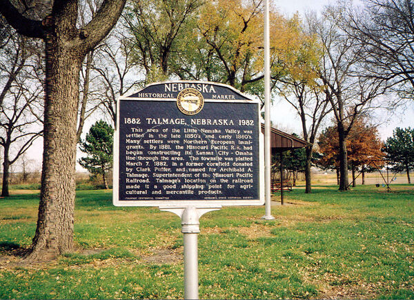
This area of the Little Nemaha Valley was settled in the late 1850's. Many settlers were Northern European immigrants. By 1881, the Missouri Pacific R.R. had begun constructing its Kansas City-Omaha line through the area. The townsite was platted March 7, 1882, in a former cornfield donated by Clark Puffer, and named for Archibald A. Talmage, Superintendent of the Missouri Pacific Railroad. Talmage's location on the railroad made it a good shipping point for agricultural and mercantile products.
Further Information
Bibliography
Marker program
See the Nebraska Historical Marker Program for more information.
