Difference between revisions of "Nebraska Historical Marker: Farmers' Valley Cemetery"
(→Location) |
|||
| Line 2: | Line 2: | ||
==Location== | ==Location== | ||
| − | + | Dead end of Farmers Valley Rd near intersection with South Y Road, Hamilton County, Nebraska | |
View this marker's location '''[https://maps.google.com/maps?q=40.721412,+-97.85367&hl=en&ll=40.72151,-97.853669&spn=0.006773,0.009645&sll=40.873253,-98.003272&sspn=0.006758,0.009645&t=h&z=17 40.721412, -97.85367]''' | View this marker's location '''[https://maps.google.com/maps?q=40.721412,+-97.85367&hl=en&ll=40.72151,-97.853669&spn=0.006773,0.009645&sll=40.873253,-98.003272&sspn=0.006758,0.009645&t=h&z=17 40.721412, -97.85367]''' | ||
Latest revision as of 09:55, 5 October 2017
Location
Dead end of Farmers Valley Rd near intersection with South Y Road, Hamilton County, Nebraska
View this marker's location 40.721412, -97.85367
View a map of all Nebraska historical markers, Browse Historical Marker Map
Marker Text
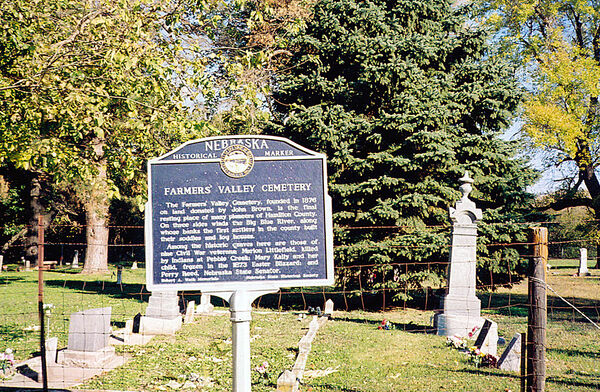
The Farmers' Valley Cemetery, founded in 1876 on land donated by John Brown, is the final resting place of many pioneers of Hamilton County. On three sides winds the Big Blue River, along whose banks the first settlers in the county built their soddies and log houses. Among the historic graves here are those of nine Civil War veterans; Marion Littlefield, killed by Indians at Pebble Creek; Mary Kaily and her child, frozen in the l873 Easter Blizzard; and Perry Reed, Nebraska State Senator.
Further Information
Bibliography
Marker program
See Nebraska Historical Marker Program for more information.
