Difference between revisions of "Nebraska Historical Marker: West Hill Community"
m |
|||
| Line 6: | Line 6: | ||
View this marker's location '''[https://maps.google.com/maps?q=41.555134,+-97.71663&hl=en&sll=41.390706,-97.49333&sspn=0.006882,0.013937&t=h&z=17 41.555134, -97.71663]''' | View this marker's location '''[https://maps.google.com/maps?q=41.555134,+-97.71663&hl=en&sll=41.390706,-97.49333&sspn=0.006882,0.013937&t=h&z=17 41.555134, -97.71663]''' | ||
| − | + | {{Marker:Map}} | |
==Marker Text== | ==Marker Text== | ||
| Line 17: | Line 17: | ||
==Bibliography== | ==Bibliography== | ||
| − | + | {{Marker:Program}} | |
| − | + | ||
Revision as of 12:48, 12 September 2017
Location
Rural 325 St, Genoa, Platte County, Nebraska
View this marker's location 41.555134, -97.71663
View a map of all Nebraska historical markers, Browse Historical Marker Map
Marker Text
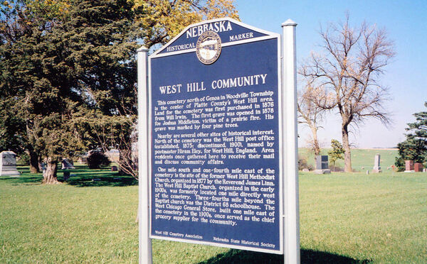
This cemetery north of Genoa in Woodville Township is the center of Platte County's West Hill area. Land for the cemetery was first purchased in 1876 from Will Irwin. The first grave was opened in 1878 for Joshua Middleton, victim of a prairie fire. His grave was marked by four pine trees. Nearby are several other sites of historical interest. North of the cemetery was the West Hill post office (established, 1875; discontinued, 1900), named by postmaster Hiram Eley for West Hill, England. Area residents once gathered here to receive their mail and discuss community affairs. One mile south and one-fourth mile east of the cemetery is the site of the former West Hill Methodist Church, organized in 1877 by the Reverend James Linn. The West Hill Baptist Church, organized in the early 1900s, was formerly located one mile directly west of the cemetery. Three-fourths mile beyond the Baptist church was the District 68 schoolhouse. The West Chicago General Store, built one mile east of the cemetery in the 1900's once served as the chief grocery supplier for the community.
Further Information
Bibliography
Marker program
See Nebraska Historical Marker Program for more information.
